Ward 11 2011 Map
Ward 11 2011 Map
Publication Date: 07/01/2010
Document Type: Maps and GIS
Sponsor:
Planning & Urban Design Agency
Summary
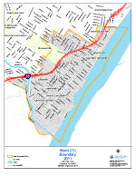
Standard letter size map.
Boundaries: Beginning at the point of intersection of the St. Louis City/County line and the Mississippi River, and proceeding westerly along the St. Louis City/County line to I- 55, and proceeding easterly along I- 55 to Koeln Ave, and proceeding westerly along Koeln Ave to S Grand Ave, and proceeding northerly along S Grand Ave to Robert Ave, and proceeding westerly along Robert Ave to Eugene Ave, and proceeding northerly along Eugene Ave to Loughborough Ave, and proceeding easterly along Loughborough Ave to Grand Dr, and proceeding northerly along Grand Dr to Holly Hills Dr, and proceeding westerly along Holly Hills Dr to Livingston Dr, and proceeding easterly along Livingston Dr to Bowen St, and proceeding easterly along Bowen St to Arendes Dr, and proceeding northerly along Arendes Dr to Wilmington Ave, and proceeding easterly along Wilmington Ave to S Grand Blvd, and proceeding northerly along S Grand Blvd to Bates St, and proceeding easterly along Bates St to Michigan Ave, and proceeding northerly along Michigan Ave to Hill St, and proceeding westerly along Hill St to S Compton Ave, and proceeding northerly along S Compton Ave to Delor St, and proceeding easterly along Delor St to Nebraska Ave, and proceeding southerly along Nebraska Ave to S Broadway, and proceeding northerly along S Broadway to River Bluff Pl, and proceeding easterly along River Bluff Pl to the Mississippi River, and proceeding easterly along the Mississippi River to the point of beginning.
Population: 11,946 (SF1 2010 Census)
Download
-
 Ward 11 2011 Map
-
Ward 11 Tabloid Size
(388.09 KB)
-
Ward 11 2011 Map with 2021 Ward Overlay
(2.29 MB)
Need Help Viewing?
You need a program that can open Adobe PDF files. A free option:
- Adobe Reader (can read PDF files)