Address & Property Search
Your search for 1100 N TAYLOR AV
Basic Info
| Primary address | 1100 N TAYLOR AV ST LOUIS MO 63113 |
|---|---|
| Owner name | RANKEN TECHNICAL COLLEGE BUILDINGS AND GROUNDS DEPT |
| Parcel ID | 4559-9-085.000 |
| Collector of Revenue account | 4559-00-00850 |
| Neighborhood | 54 - Lewis Place |
| Ward/Precinct | Ward 12, Precinct 1 |
| Property Class | COMMERCIAL |
| Tax Abatement | This property is not abated |
| Property description
Not meant for use in recorded legal documents |
CB 4559 TAYLOR AV, 72.25 FT X 72.25 FT, GHIOS ADDN, LOT S-18 SW-17 |
Maps
Parcel Map
Parcel information, streets, and strategic land use planning (SLUP) information.
Zoning Map
Zoning for this parcel: F. Neighborhood Commercial
Legend
-
 A. Single Family Residential
-
 B. Two Family Residential
-
 C. Multi Family Residential
-
 D. Multi Family Residential
-
 E. Multi Family Residential
-
 F. Neighborhood Commercial
-
 G. Local Commercial
-
 H. Area Commercial
-
 I. Central Business
-
 J. Industrial
-
 K. Unrestricted
-
 L. Jeffersion National Memorial
Right of Way Map
Measurements, easements, vacated ordinances, blocks, lots, subdivisions, etc.
Historic Maps
Plat maps provide information about parcels of property for tax purposes. They can be helpful in answering property boundary questions. The historic plat maps provided serve as archival records and are not updated.
Real Estate and Property Information
Data provided by Assessor's Office
Property Information
| Owner name: | RANKEN TECHNICAL COLLEGE BUILDINGS AND GROUNDS DEPT |
|---|---|
| Owner mailing address: | 4431 FINNEY AVE ST LOUIS, MO 63113 |
| Property address | 1100 N TAYLOR AV ST LOUIS MO 63113 |
| Alternate address |
1102 N TAYLOR AV 1104 N TAYLOR AV 1106 N TAYLOR AV 1108 N TAYLOR AV Show More |
| Zip code | 63113 |
| Parcel ID | 4559-9-085.000 |
| Collector of Revenue account | 4559-00-00850 |
| Year built | N/A |
Parcel Information
| Condominium | No |
|---|---|
| Number of units | n/a |
| Frontage | 0.00 feet |
| Land area | 5220.00 |
| Property description
Not meant for use in recorded legal documents |
CB 4559 TAYLOR AV, 72.25 FT X 72.25 FT, GHIOS ADDN, LOT S-18 SW-17 |
Land Use Information
| Property use | Commercial |
|---|---|
| Property class | COMMERCIAL |
| Zoning | F - Neighborhood Commercial |
| Redevelopment code | N/A |
| Vacant lot | No |
| Deed records: | Search Recorder of Deeds data |
Appraised Value
Please note that this parcel is tax abated under both Missouri Statue and City of St. Louis ordinance. Under the terms of the abatement, the assessment does NOT have a direct correlation to market value for the duration of the abatement. As an abated parcel, the Assessor does not determine an estimate of market value for biennial reassessment. The market value shown is merely the assessed value divided by the appropriate assessment ratio.
BackAssessment Information
The assessed value reflects the parcel/property as it existed on January 1 of the appropriate assessment year. Any changes made to the parcel/property after January 1st will be reflected after the next reassessment of the property.
Current 2025 Assessed Values
| Commercial Land | $1,700.00 |
|---|---|
| Commercial improvements | $1,800.00 |
| Assessed total | $3,500.00 |
| Appraised total | $10,900.00 |
Prior 2024 Assessed Values
| Commercial Land | $1,700.00 |
|---|---|
| Commercial improvements | $1,800.00 |
| Assessed total | $3,500.00 |
| Appraised total | $10,900.00 |
Sales History
| Sales date | Sales Price | Transaction Type |
|---|---|---|
| 05/10/2007 | $240,000.00 | Unverified |
| 06/21/2006 | $58,000.00 | Unverified |
Real Estate Tax Summary
Data provided by Collector of Revenue
Collector of Revenue Account Number: 4559-00-00850
| Tax Year | Total Original Tax | Balance | Action |
|---|---|---|---|
| 2025 | $341.34 | $0.00 | Print Receipt |
| 2024 | $350.38 | $0.00 | Print Receipt |
| 2023 | $336.00 | $0.00 | Print Receipt |
Disclaimer
The information on this site is updated weekly, and may not show the most current balance. Please note that due to statutory regulations and some time-sensitive cases, not all accounts can be paid using the online payment system. We apologize for this inconvenience. If you have any additional questions or concerns, please contact the Real-Estate department at (314) 622-4106.
Building Permit Records
| Owner Name | Permit Type | Application Date | Completion Date | Issued Date | New Use | Estimated Costs | Description |
|---|---|---|---|---|---|---|---|
| ANDERSON, BERNARD & PATRICIA | Plumbing | 05/21/2013 | $2,250.00 | WATER TAP DESTROY | |||
| ANDERSON, BERNARD & PATRICIA | Plumbing | 05/21/2013 | 05/21/2013 | $2,250.00 | WATER TAP DESTROY | ||
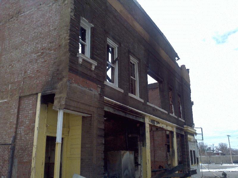
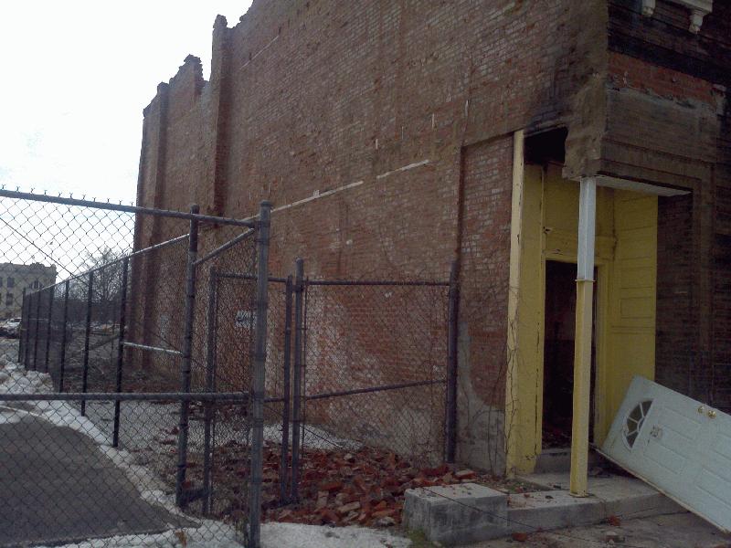
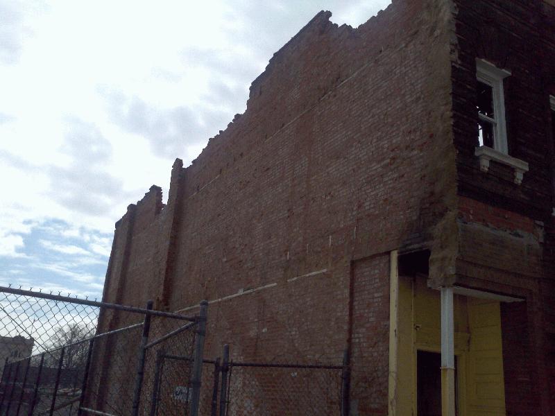
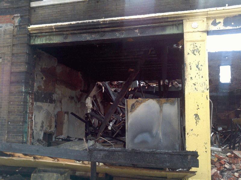
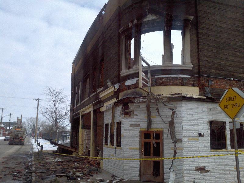
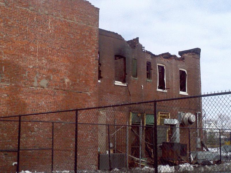
| ANDERSON, BERNARD & PATRICIA | Demolition | 05/06/2013 | 06/24/2013 | 05/29/2013 | $20,000.00 | WRECK 2 STORY COMMRCIAL BRICK BLDG | |
| ANDERSON, BERNARD & PATRICIA | Electrical | 04/03/2012 | 04/03/2012 | $400.00 | |||
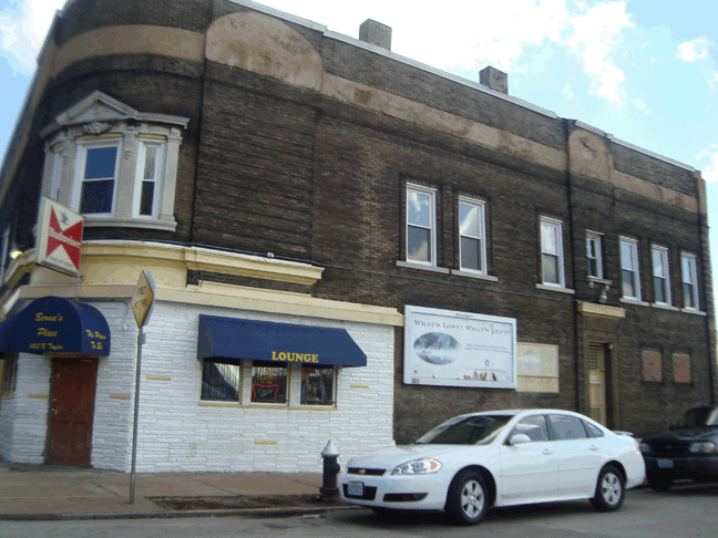
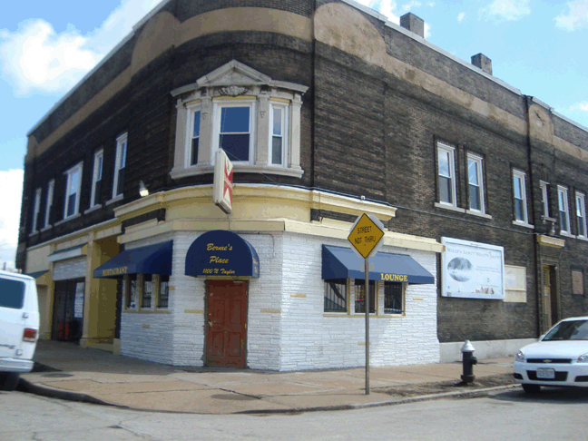
| BERNIE'S PLACE | Mechanical | 12/10/2007 | 12/10/2007 | $5,500.00 | INSTALL 2 VENT SYSTEMS |
View all building permits for 1100 N TAYLOR AV ST LOUIS MO 63113
Data provided by Building Permits Section
Boundaries and Geography
Geographic Boundaries
| City block number | 4559.00 |
|---|---|
| Neighborhood | 54 - Lewis Place |
| Ward/Precinct | Ward 12, Precinct 1 |
| Census tract | 1112.00 |
| Census block | 1050 |
| Assessment neighborhood | C234 |
| Housing conservation dist. | Your Address is Not in A Housing Conservation District. |
| Zoning | F - Neighborhood Commercial |
Economic Development Areas
| TIF district number | No |
|---|---|
| Enterprise Zone | No |
| HUBZone | Yes (More Info) |
| HUD qualifying census tract (2022) | Yes (More Info) |
| Community needs grant | Yes (See Ordinance 71504) |
| Midtown redevelopment | No |
| Special business district | No |
Trash and Maintenance
Data provided by Streets Department
Refuse Schedule
Roll Out Carts
Showing regular schedules below. View Holiday Schedule.
Trash: Tuesday
Recycling: Friday
Yard waste: Wednesday
Yard Waste collection is discontinued in the middle of December and resumes in the middle of March.
Large bulk items: Week of the 2nd Monday of the month
Alley Dumpsters
Trash: Pick up at least once per week (please use brown and blue dumpsters).
Yard waste: ThursdayYard Waste collection is discontinued in the middle of December and resumes in the middle of March.
Large bulk items: Week of the 2nd Monday of the month.
Drop-Off Recycling
Nearest Drop-off Recycling Location:
Seasonal Cleanup
Forestry Cutting Schedule
This property is not on the cut schedule.
Operation Brightside
OB Region: Region 2 North
Snow Route
Help Us Improve This Page
Did you notice an error? Is there information that you expected to find on this page, but didn't? Let us know below, and we'll work on it.
Feedback is anonymous.
112 comments from people like you have helped us improve this page. Keep the feedback coming!